Showing posts with label Bennington County. Show all posts

12/3/09

Woodford

This is the southernmost cross-state road in Vermont (Brattleboro to Bennington)...I once had a New York guest who had come that way over Hogback in the late afternoon, and the next morning before the rest of us were out of bed we discovered that he had got up and driven back twenty miles up Hogback to drink in that view once more...Charles Edward Crane


Woodford is the kind of Vermont town that you pass on the road before recognizing you've entered or left it--then turning around in someone's driveway (hoping he's not glaring suspiciously out his window) you head back the way you came, still searching for some sign of local identity.

Woodford is so lacking a center that it's sarcastically referred to by local scoffers as "Woodford City" ("Woodford City Stream" and "Woodford City Road" can be found in my Vermont atlas, so the insult seems to have stuck.) But like so many other nondescript, seemingly non-towns in Vermont, interesting discoveries reward closer examination.

I found out that Woodford is defined by its altitude, not its architecture. At 2,2oo feet, it's the highest town in the state (and 400 residents make it one of the smallest towns.) Woodford sits at this great height in the middle of Green Mountain Forest wilderness. Fortunately for local residents, 398 acres of these spruce, fir and birches, lakes, ponds and rills have been set aside for camping, hiking and fishing. This highest state park in Vermont also bears the proud name of "Woodford".

Route 9 between Bennington and Brattleboro is sometimes called the "Molly Stark Trail". Molly's husband, General John Stark, was instrumental in repelling the British near Bennington, thereby turning the tide of the Revolutionary War. (His famous battle cry was, "The Red Coats and the Tories...are ours, or this night Molly Stark sleeps a widow!", and fortunately for all of us, she didn't.) But Molly is also honored with place names all around southern Vermont in her own right as a selfless nurse and brave patriot.


This Molly Stark trail heading east from Bennington is one of the loveliest, and also loneliest, stretches of two-lane road in the state. Rolling down from the apex of "Woodford City", I admire the people who live so comfortably isolated here, every night falling asleep amidst mile upon mile of silent mystery.

11/28/09

Bennington

Vermont was born in a hotel. The Green Mountain Tavern in Bennington, known as Catamount Inn, had as a sign a stuffed catamount lion grinning toward New York. Here the Green Mountain Boys gathered. Here New York sympathizers were delivered for the high chair treatment--hoisting in a chair of ignominy from the porch roof. Here Ethan Allen planned the taking of Ticonderoga. Here the pioneers drank, not only with their eyes, but lustlily with rum to the new republic, as is evidenced by Allen's tap-room bill, still preserved...Charles Edward Crane


I'm happy to say I'm back on the Vermont road again, after a summer and fall of painting deadlines and travels far from my home state. Thank you, dear readers, for a long, patient wait! Let's take up where we left off, on Route 7 heading north into Bennington near the New York border.

Bennington is large enough to have sections with distinct personalities and histories ("Old", "North" and "Downtown"), and venerable enough to have played an important role in the drama of the founding of both the "Republic" of Vermont and the independent United States. A walk in Old Bennington takes you past buildings haunted by righteously angry ghosts--from the Old First Church (the original Protestant congregation in Vermont), to the site of the Catamount Tavern (in the 1770's the favorite watering hole of revolutionary conspirators against the powers of New York and England) and finally up to the heights of the Battle Monument obelisk.


The Battle of Bennington actually took place right across the border in New York, but it was fought by area farmers and woodsmen. British and Prussian troops (worn out by fanatical Monty Python-style precision drilling) were sure they would have no problem raiding Vermont for stores and ammunition on their march south to finish business with the rebellious colonies. Instead the royal army was defeated in a rout, and Bennington went down in history as one of the few battles where improvised troops beat trained contingents. As captured General Burgoyne wrote to his rulers in England, Vermont was a place "that abounds with the most active and rebellious race on the continent, and hangs, like a gathering storm, on my left." (Enter, 230 years later, Senator Bernie Sanders.)


You'll leave the ghosts of our political revolution and encounter remnants of the Industrial Revolution as you drive east into downtown Bennington. Textile and paper mills, iron furnaces and grist mills all provided jobs and fed the local economy until Vermont manufacturers could no longer compete with cheaper products.

This loss of industry was widespread--but one manufacturer from the 19th century that has survived and flourished to the present day is Bennington Pottery--an example of the importance of artistry as well as functionality in a product. Another survivor from the past is artsy Bennington College, founded in 1932 as an experiment in "self-dependence" for its mostly female student body. (All the Bennington graduates I know, including a guy, are smart and creative people, so the experiment must have worked.)

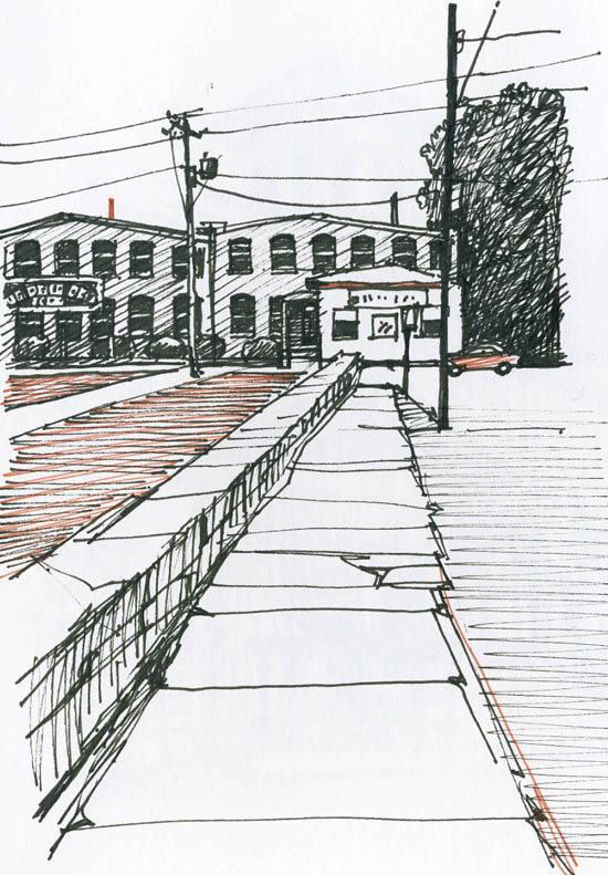
Driving out of town, I kept pulling the car over to the curb to get a closer, slower look at Bennington's old architecture. Some of these mills, stables, factories and homes look lovingly restored, some are reinvigorated and put to new uses, and some are decaying and seem forgotten in time. Each of these glimpses down an old sidewalk or back street evokes this town's long lost past, and seems to hold some meaning (even if I can't quite grasp it) for our future.

6/1/09

Pownal

Commonly chosen routes for getting north are the cemented highays, U.S. 7 on the west...known as the Ethan Allen Highway, and for all its length it has associations with the Green Mountain Boys and the early history of Vermont. The gateway is at Pownal...and after a lung-filling and eye-filling view from the Pownal road you are soon in Bennington...Charles Edward Crane


Last week I found myself one warm, sunny morning driving across the southern border of Vermont, thinking about how my nineteen year old son would soon be walking across the same state line with a sixty pound pack on his back. I had just dropped him off at the start of the Long Trail in Williamstown, Massachusetts, where he was setting off for a three week, 270 mile trek along the ridge of the Green Mountains all the way to Canada. The Long Trail is the oldest long-distance hiking path in the U.S., and was the inspiration for the more-famous Appalachian Trail.


Like so many Vermont (and American, as Alexis de Tocqueville noted) enterprises, the Long Trail was conceived, built and maintained by visionary volunteers. The original dreamer was James P. Taylor, who one morning in 1910 while waiting for the mist to clear from the top of Stratton Mountain had the rather crazy idea of a path that could run through the Greens from the top to the bottom of Vermont.

The state's peaks had been largely unappreciated and unused for recreation until Taylor decided to help "make the Vermont mountains play a larger part in the life of the people." His dream took its first step towards reality at a small gathering of outdoor enthusiasts in Burlington, the first of a hundred years of meetings (and subsequent trail clearings) by the Green Mountain Club.

So while my son began his adventure ten miles behind and a thousand feet above me, I drove into the Pownal valley, and as usual when coming back to Vermont felt myself slip a bit back in time.


When I used to drive from Washington to Lake Champlain for summer vacations, I usually crossed into Vermont on Route 7, and I remembered the area for the creepy greyhound race track that was visible from the road. It's been vacant for over ten years now, though plans for some interesting commercial development (including a farmer's market) are in the works.

Now you can see vestiges of the tourism industry of our grandparent's time. I always covet these little guesthouses that are still settled along rivers all over the state, and want to take one up to our back acres, a retreat for mini-vacations at home.

Pownal has a long and complicated history, settled first by native Americans eons ago, then claimed by the Dutch in the late 1600's and finally passing later that century into English hands. By the Revolutionary War, settlers began arriving to the town (named for the head of the Massachusetts Bay Colony) from the more crowded Southern parts of New England. Their claims set the stage for a brewing war with wealthy New Yorkers who thought they'd been granted the same Vermont acres by England, a simmer that was to come to a full boil during the Revolutionary War when towns like Pownal split between Tories and Green Mountain Boys. Guess who won!

An itinerant minister was less than impressed with free and independent Pownal when he came over the mountain for a visit in 1789: “Pawnal ye first town, poor land – very unpleasant – very uneven – miserable set of inhabitants – no religion..." That was HIS opinion, anyway; the Pownalers would have probably answered him disdainfully with a pithy retort about private beliefs and personal responsibility.

By the 1900's Pownal did have churches, plus ten schools, textile mills (a Lewis Hine image of “Anemic Little Spinner in North Pownal Cotton Mill" helped inspire the first child labor law), and a Berkshires to Bennington electric railroad. The mills are gone forever, but maybe the train will be back.


Until then, to visit the town of Pownal take a short detour from Route 7 to Route 346, which will also allow you to see North Pownal (look sharp or you'll end up in New York) and best of all, drive the back roads to Bennington.

More about Pownal